



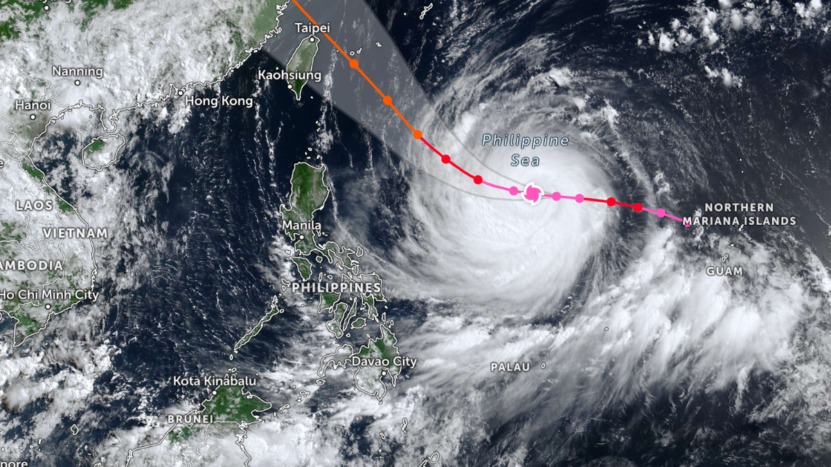

Batanes, Cagayan, and a string of towns across northern and central Luzon were placed under the lowest storm signal early Wednesday as Super Typhoon Inday moved into Philippine territory, according to the state weather bureau.

PAGASA reported in its 5 a.m. bulletin that the storm crossed into the Philippine Area of Responsibility at 3 a.m., carrying maximum sustained winds of 185 kph near its center with gusts reaching 230 kph. The typhoon was tracked 1,405 kilometers east of Northern Luzon and had picked up speed, advancing westward at 25 kph after previously moving at 20 kph.
Forecasters said the system is not expected to strike land. Its greater effect will come from strengthening the southwest monsoon, or habagat, which is set to dump additional rain across wide stretches of the archipelago.
As of 5 a.m. on July 8, Signal No. 1 covered Batanes; Cagayan including the Babuyan Islands; Apayao; the northern and central portions of Isabela; the eastern portion of Kalinga covering Pinukpuk, the City of Tabuk, and Rizal; the northern portion of Aurora covering Dilasag; and the northern and central portions of Catanduanes covering Pandan, Caramoran, Bagamanoc, Panganiban, Viga, Gigmoto, Baras, and San Miguel. The warning expanded from an earlier list of five Cagayan towns flagged at 11 p.m. Tuesday as the storm drew nearer to land.
Communities under Signal No. 1 face winds of 39 to 61 kph, which PAGASA classified as posing little threat to life or property. The bureau cautioned, however, that gusts could run stronger along coastlines and in higher elevations directly exposed to the wind. “Winds are less strong in areas sheltered from the prevailing wind direction,” it said.

PAGASA indicated the strongest warning likely during Inday’s passage would reach Signal No. 2 or 3, though no locality had been raised to that level as of the morning report.
The combined pull of the enhanced habagat and the typhoon’s outer bands is forecast to whip up strong to gale-force gusts, hitting Pangasinan, Zambales, Bataan, CALABARZON, most of MIMAROPA, the Bicol Region, and much of the Visayas and Mindanao on July 8, before spreading to most of the country on July 9 and July 10.
Rainfall warnings ran alongside the wind advisories. Sultan Kudarat and Sarangani were expected to see 50 to 100 millimeters of moderate to heavy rain on July 8, a level forecast to shift to Occidental Mindoro, Palawan, Antique, and Negros Occidental the following day. By July 10, the affected zone widens: Occidental Mindoro and Antique brace for heavy to intense rain, Batanes for moderate to intense, and a longer roster including Zambales, Bataan, Metro Manila, Cavite, Batangas, Palawan, Guimaras, Iloilo, both Negros provinces, and Lanao del Norte and del Sur for moderate to heavy downpours. “Forecast rainfall may be higher in mountainous and elevated areas. Moreover, impacts in some areas may be worsened by significant antecedent rainfall,” the bureau said.
At sea, the highest swells are projected off Isabela, northern Aurora, northern and eastern Catanduanes, and the eastern coast of Northern Samar, where waves could climb to 4.5 meters. Waters reaching up to 4.0 meters were forecast for the northern and eastern seaboards of Batanes and the Polillo Islands, along with the eastern coasts of Cagayan, Albay, Sorsogon, Eastern Samar, and the Dinagat Islands, among others. Vessels in these waters risk being swamped, a standing hazard whenever such wave heights are recorded.
