


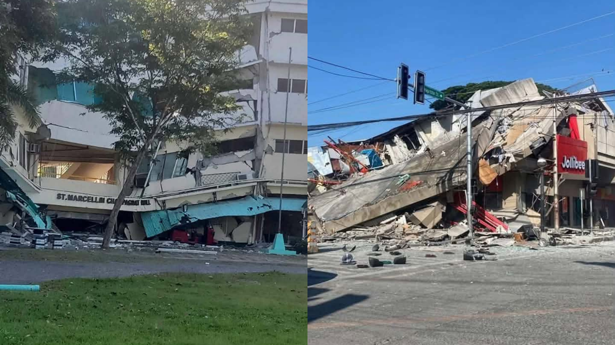

Malapatan in Sarangani bore the strongest recorded ground motion when a powerful earthquake tore through southern Mindanao early Monday, with the Philippine Institute of Volcanology and Seismology logging Instrumental Intensity VIII in the coastal town. The tremor hit at 7:37 a.m. and was traced to a point 32 kilometers south of Maasim, Sarangani, at a depth of 33 kilometers.

Phivolcs revised the magnitude upward to 7.8 in its second bulletin, a sharp increase from the 7.0 figure carried in its initial report, which had placed the epicenter closer to General Santos City. The recalculation is consistent with how the agency refines readings as additional seismic data arrives from its monitoring network.
General Santos City registered Intensity VII among reported felt intensities, the highest in that category, while residents in Palimbang and Senator Ninoy Aquino in Sultan Kudarat reported Intensity VI shaking. The quake was felt across a wide swath of the south, reaching Davao City, Kidapawan, and parts of Zamboanga del Norte at Intensity V, and stretching as far north as Abuyog and Dulag in Leyte, where people reported Intensity II.

Instrument readings traced the heaviest energy along the Sarangani coastline. Beyond Malapatan’s Intensity VIII, Koronadal in South Cotabato and Santa Maria in Davao Occidental each recorded Intensity VII, with T’boli and General Santos City logging Intensity VI.
A magnitude 3.7 aftershock followed at 8:11 a.m., located off Balut Island in the municipality of Sarangani, Davao Occidental, at a depth of 33 kilometers. General Santos City felt that smaller jolt at Intensity IV.
Phivolcs urged coastal residents to watch for the natural warning signs of a local tsunami: strong ground shaking, a sudden drop in sea level, or an unusual roar resembling an approaching wave. The agency said anyone who observes any of these should move at once to higher ground or away from the shoreline, and reminded the public to practice Duck, Cover, and Hold during tremors.
