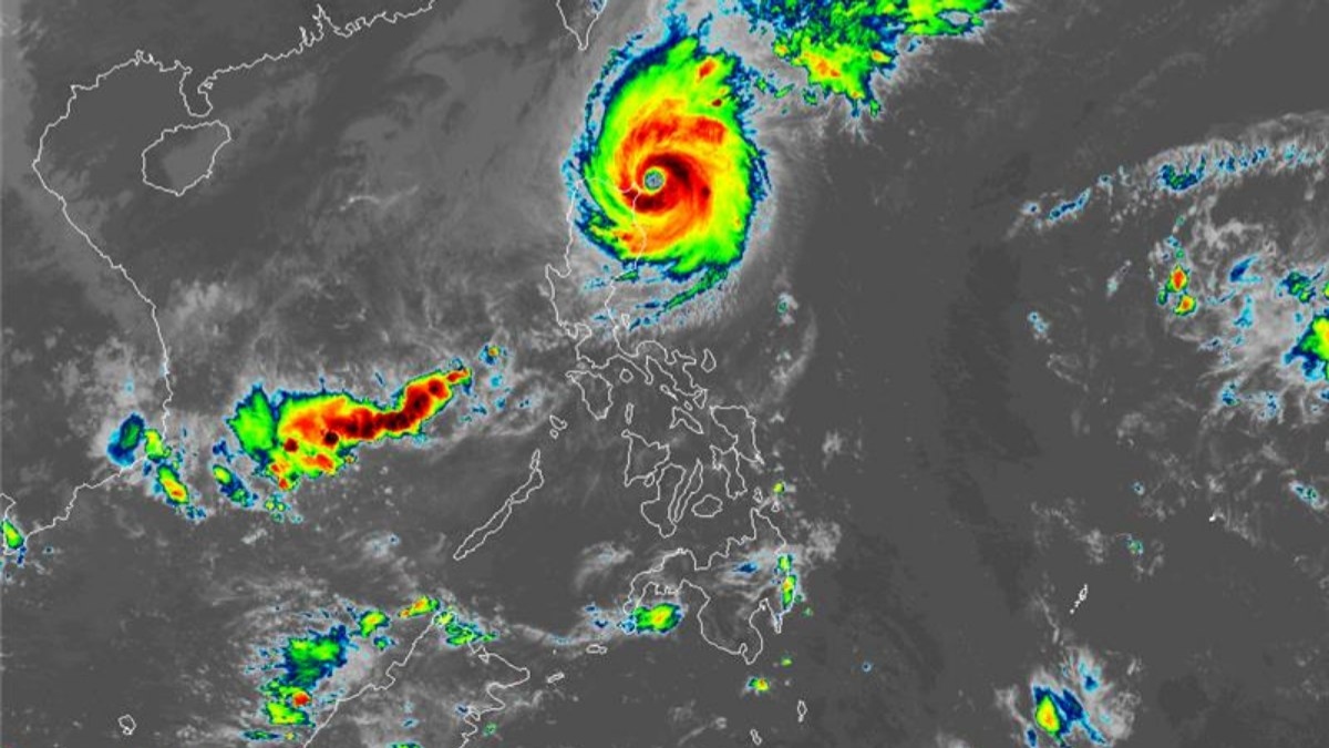
Typhoon Marce intensified to near-super typhoon levels on Thursday morning as it moved closer to Luzon’s northern region, according to PAGASA, the state weather bureau.
As of 10 a.m. (PH time), Marce had sustained winds reaching 175 kilometers per hour, with gusts of up to 215 kph. The typhoon was last recorded 115 km east of Aparri, Cagayan.
Marce is expected to make landfall and either cross or pass very close to the Babuyan Islands, as well as northern sections of Cagayan, Apayao, and Ilocos Norte, from Thursday afternoon to early Friday morning.
The weather bureau warned of damaging winds, heavy rainfall, and storm surges potentially exceeding 3 meters, posing a significant to severe threat to life and property in the affected areas.
PAGASA has issued Signal No. 4 for areas at risk of winds between 118 and 184 kph, which could cause severe damage, including roof destruction and tree toppling. These areas include:
Northern Cagayan (including Gonzaga, Santa Ana, and Aparri)
Babuyan Islands
Northern Apayao and northern Ilocos Norte (including Pagudpud and Bangui)
Signal No. 3 has been raised for areas expected to experience winds between 89 and 117 kph within the next 18 hours. This alert covers:
Batanes
The remainder of Cagayan, Apayao, and Ilocos Norte
Northern sections of Abra and Ilocos Sur
Areas under Signal No. 2, where winds of 62 to 88 kph are expected within 24 hours, include:
Parts of Isabela, Abra, Kalinga, Mountain Province, and northern Benguet
Rest of Ilocos Sur and parts of La Union
Signal No. 1, for winds of 39 to 61 kph expected within 36 hours, affects:
Remaining parts of La Union, Pangasinan, Ifugao, and Benguet
Additional areas in Isabela, Quirino, Nueva Vizcaya, and Aurora
Northern portions of Nueva Ecija and Zambales
PAGASA forecasts that Marce will exit the Philippine area of responsibility by Friday afternoon. Residents in the affected regions are advised to stay alert and prepare for possible impacts.


