


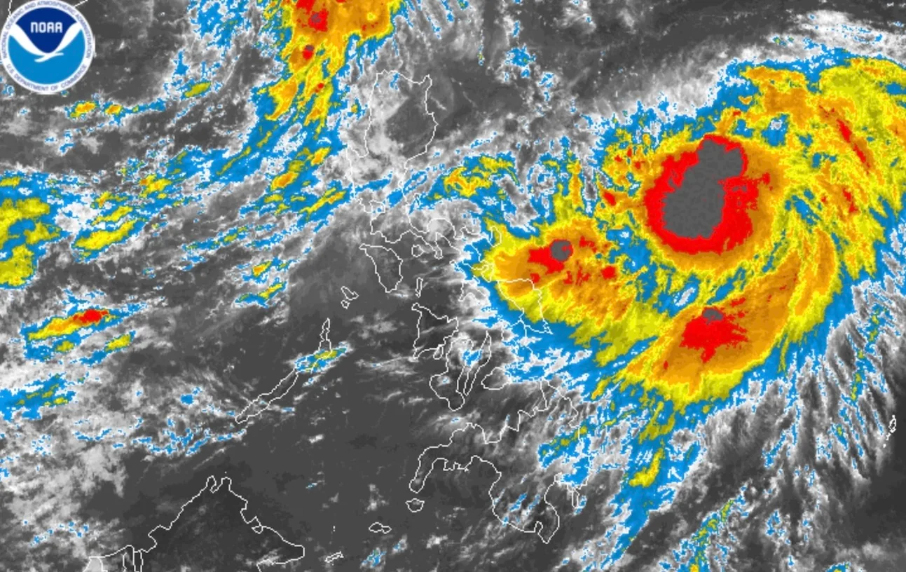

Tropical Storm Nando continues to strengthen over the Philippine Sea and could reach typhoon—and possibly super typhoon—intensity in the coming days, the state weather bureau warned.

As of 4 p.m. Friday, PAGASA said Nando was spotted 905 kilometers east of Central Luzon, packing maximum sustained winds of 85 kilometers per hour and gusts of up to 105 kph. The system is moving west-northwest at 10 kph. While no storm signals have been raised yet, Northern Luzon may be placed under Signal No. 1 as early as today.
On its current track, the cyclone may approach or make landfall over the Babuyan Islands between Monday afternoon and early Tuesday before leaving the Philippine area of responsibility. PAGASA added that Nando will also boost the southwest monsoon, bringing heavy rains to CALABARZON, Bicol, Visayas, Northern Mindanao, and Caraga starting Sunday.

Bicol, Eastern Visayas, and Caraga are likely to experience gusty conditions as early as Saturday. Cloudy skies with scattered rains and thunderstorms are expected over Catanduanes, Albay, Sorsogon, Masbate, Northern Samar, and Eastern Samar, with risks of flooding and landslides. Meanwhile, Metro Manila, Ilocos Region, Cordillera, CALABARZON, MIMAROPA, the rest of Visayas, and parts of Luzon will have generally fair to cloudy weather with isolated showers.
As Nando nears, sea conditions are forecast to worsen. Coastal waters around Luzon could turn rough to very rough, with waves reaching up to 14 meters near Northern Luzon. PAGASA said a storm surge warning may also be issued in coastal areas.
The Department of Social Welfare and Development (DSWD) has already placed its teams on full alert. Assistant Secretary Irene Dumlao of the Disaster Response Management Group said more than 2.6 million family food packs and other relief items have been prepositioned nationwide to ensure immediate assistance once the storm strikes.
