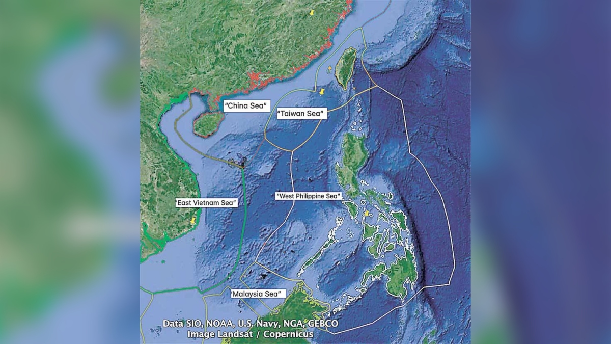
The National Mapping and Resource Information Authority (Namria) announced plans to release a new Philippine map that will formally include the West Philippine Sea (WPS) within its jurisdiction. Namria Administrator Peter Tiangco confirmed on Friday that the maps are already prepared and only await the implementing rules and regulations (IRR) for the newly signed Philippine Maritime Zones Act, or Republic Act (RA) No. 12064.
President Ferdinand Marcos Jr. signed the Act earlier on Friday, solidifying the country’s maritime zones in accordance with the United Nations Convention on the Law of the Sea (UNCLOS). This move aims to define the extent of the Philippine maritime domain and establish the nation’s legal rights over these waters.
Tiangco emphasized in an Inquirer.net report the distinction between the forthcoming Philippine map and China’s updated version, which extended its territorial claims to include a “10-dash line” covering Taiwan and most of the West Philippine Sea. “The big difference here is that our map has legal basis supported by existing laws,” he highlighted, speaking in a mix of Filipino and English.
Additionally, Marcos signed the Philippine Archipelagic Sea Lanes Act (RA No. 12065) to safeguard the nation’s sovereignty and maritime territory. This law sets designated routes for foreign military and civilian vessels, ensuring that such movements comply with UNCLOS and the Chicago Convention on International Civil Aviation.


